Sunday, May 23, 2010

Don't Change My Freeway!


One of the first freeways built in the western US, was the Pasadena Freeway. Originally called Arroyo Seco Parkway, it has also been known at US 66 and now "The 110". The parkway was the beginning of the massive web of freeways around Los Angeles.

Arroyo Seco is Spanish for Dry Streambed. This route was first used by wagons in the 1800's during the dry summer season as a better alternate than the regular roads. There were attempts to use the path for an elevated bicycle route at the end of the 19th century, but the bicycle craze ended, especially since a rail line was there and the motorcar was starting to change the traveling landscape.

The Parkway was in some ways designed as more of a park than a roadway. It was very modern for 1940. The route became a speedy way for the business barons to commute between they downtown jobs and their beautiful homes in the Pasadena suburbs. Instead of solid medians there were merely flowers and a art deco curb dividing the northbound from the southbound lanes.

The parkway was built with stylish Art Deco bridges, tunnels and overpasses. Most of the ramps were an easy merge with the lighter traffic then, but some of the intersections were right angle turns giving hardly any time to get up to speed. Some still have a stop sign protecting you from the steady stream of cars flying by. A few of the bridges were built to cross the Arroyo Seco canyon long before the consideration of a freeway.

Built to handle 27,000 cars a day at 45 mph, it was a relaxing drive down the parkway. As Los Angeles expanded and more freeways were built the medians floral displays gave way to a steel railing. Today the freeway carries about 125,000 cars on virtually the same roadway that was opened 70 years ago.

The California Department of Transportation (or Caltrans) say it's a very accident prone highway due to speeding drivers. Many accidents damage the divider's steel railing. It's harder to repair than a concrete barrier and concrete barriers are safer, too. Since there is no good alternate for traveling between Pasadena and L.A., the state transportation department is in process of changing the parkway into a less dangerous and more-modern freeway. However, when it comes to a Historic Highway, safety isn't everything to everybody. Some are protesting the safety improvements as too much of a change to this National Civil Engineering Landmark.

Among the original design features to be removed are the curbs with designations built in to note the direction of travel. Parkway lovers say that those designations are as important as the Art Deco bridges and sycamore trees lining the route.

The changes still appear to be on the Caltrans schedule.

Links
AP News Story
History at Wikipedia
Postcard views
LA Times construction photos
Virtual Drive The 110
Google Map
Downloadable Los Angeles Map
The Freeways of Los Angeles Book


Copyright 2010

Thursday, December 31, 2009

Happy New Year!


courtesy AARoads Shield Gallery
Make your own Shield at the AARoads Shield Generator

Thursday, December 17, 2009

Saving an 1887 bridge in Texas

As a fan of Old Routes, it’s great to see an old bridge saved and preserved. For a century old bridge in Texas to still be used, even though only for Pedestrians, is a real bonus. Go here to check out the story of the 1887 built bridge in New Braunfels, Texas.

View Larger Map

Links

More photos of the Faust St Bridge
Faust St bridgebuilder the King Bridge Company
Other Historic Whipple Truss bridges in the US
Six Bridges : The Legacy of Othmar H. Ammann
Backroads of the Texas Hill Country: Your Guide to the Most Scenic Adventures
Texas Road Trip (Chisholm Trail Series)


Sunday, December 6, 2009

Route 66: America’s First Main Street

This Route 66 book can be hard to find, but if you can find a copy, it’s a nice casual read. The author, Spencer Crump, takes you on a historical road trip. It has the feel of a personal scrapbook or journal with his historical musings on the road and events of the early 66 era of the 20s and 30s.

Crump includes a variety of period postcards, photos and ads to give you a better feel of the time. It’s hard to imagine hotels for a buck a night, 5-cent hamburgers and 22-cent gasoline, but the visual proof is there. There’s even something that gas stations had called, “Service with a Smile”.

Other than the cover, it’s all black and white, which does well with the historical feel of the book. Indeed, it is more than a 66 picture book. One of the real highlights for the road geek or old route fan is copies of Vintage maps from the Automobile Club of Southern California.

Buy the book Route 66 - America's First Main Street
Check out the curios at the Old Routes Souvenir Shop

Copyright 2009 - All the World Travel LLC and Dan Smith

Friday, September 11, 2009

Route 66 Re-Signed in Missouri

Carthage Missouri has a brand new set of Route 66 signs to guide travelers along the Mother Road. Many feel getting Route 66 re-signed will help bring interest to the old route as well as tourist dollars to the interstate bypassed cities.

Follow this link to the Carthage Press story.

And more links to other sites about 66 in Missouri.
More on the 66 Missouri Byway
The longtime proponent of Route 66 is Bring Back Route 66
66 history in the Missouri Ozarks
Missouri 66 Books and Guides


Sunday, August 2, 2009

The Rock Cafe is Rocks Back to Life

It’s been a popular Route 66 stop since 1939 and a year after fire gutted everything but its stone walls, The Rock Café in Stroud Oklahoma has reopened. The café was named for its walls made of rock removed to build Route 66 between Oklahoma City and Tulsa.
Owner Dawn Welch has kept busy cleaning up the restaurant, considering her own cooking TV show and writing a cookbook called Dollars to Donuts.
More about the Rock Café on OldRoutes.com
And other Links
Story about reopening with video from NewsOK.com
Rock Cafe's Blog
Owner Looks Back on year from news9.com.
Buy Dawn Welch's book, Dollars to Donuts.


View Larger Map


Thursday, December 25, 2008

MERRY CHRISTMAS from OldRoutes.com

and a Happy and Safe New Year of enjoying Old Routes!

Sunday, October 5, 2008

Tucumcari via France

The Route 66 song got its kicks while skipping right by Tucumcari, New Mexico. I guess Bobby Troup couldn’t get every Route 66 city in his song. Even so, Tucumcari, New Mexico was an oasis for US 66 travelers near the Texas-New Mexico border.
In 1901 the railroad came and Tucumcari was born. In 1926 the road in and out of town was numbered US 66.
The city has some of the more famous hotel signs along old 66. The neon 1939 Blue Swallow Motel is a favorite with “refrigerated air.” The artistic rendition of Route 66 and the tailfin-lights of a car is certainly worth seeing as is the historic train station. You can click on the pictures for a bigger view.
Like most old routes cities, they were bypassed by a newer highway. France 24 TV News recently did a story on the downturn of the Tucumcari’s economy and you can see it here. It’s interesting to see the European view on 66’s demise. If you didn’t know better, the story could make you think that 66 was bypassed last month.
Tucumcari was named for Tucumcari Mountain to the southeast of town. This mountain was the inspiration for Radiator Springs Mountain in the movie, “Cars”. You may have seen real life pictures of the area if you watched the TV show, “Rawhide”. The star of Rawhide, Clint Eastwood, returned to film a scene for the movie, “For a Few Dollars More”.
It’s easy to find old 66 here as they have renamed it Route 66 Boulevard.

View Larger Map

Links
City of Tucumcari
Tucumcari in song, movies and TV
Tucumcari Chamber of Commerce site with more visitor information


Friday, October 3, 2008

On the Move should be on your bookshelf

If you removed all the text from On the Move, the photos and illustrations could stand alone to make this an excellent book. The book is a cooperation of National Geographic and the Smithsonian Institution and it shows. The book is filled with clear jump-off-the-page pictures dating back to the late 1800’s. I’m so used to thinking of the past in monochrome black and white or at the best brownish sepia. This makes the color from the past so bright with new photos of old transportation equipment from the Smithsonian’s collection. I never imagined the color of the past in the rich red gas pump, the glorious green locomotive, or the 40’s golden yellow Dodge school bus.

On the Move gives a great overview of not only facts and figures of transportation, but societal changes that were part of it. Thankfully, it’s getting harder to imagine a time when there was a need for “The Negro Motorist Green-Book” to find a place where they could buy gasoline or get a meal or warm bed for the night. Suburbia grew first from mass transit and then from speedy travel on high speed non-stop freeways. A new culture was built around the car, while other urban cultures were split in two by Interstate highways.

For the lover of all roads or the Road Geek like me, the photos of road building, old roads, gas stations and even advertising to take me back to a time. This was a time before I was born, when modern transportation and travel was like an infant with so much to grow and so much to create.

This book is partly based on the Smithsonian’s exhibit “America on the Move” which just reopened in Washington, DC. The History Channel also produced a DVD also called On the Move 1876-2000.


Copyright 2008 All the World Travel and oldroutes.com


Tuesday, September 30, 2008

RG's New Ford Sport Coupe

When the Old Routes were first built, it could be a rough route… mud, potholes, washboard, sand… cows, fences, angry horsemen, even gates to open. The cars weren’t much better, especially by today’s standards.

In our day of hot or cold beverage holders, entertainment systems we can talk to and GPS to guide us to the nearest Starbucks with a drive thru… it is very hard to picture what is was like to take a road trip in the early 20th century.

This picture might help. Late May 1930 R.G. Thompson had had enough of that ole Hudson Brougham. It was a pretty warm day, but he left his tie and coat on hoping the car salesman wouldn’t try to take advantage of him. He headed out from the Stock Exchange Building up 4th Avenue and uptown on Westlake to the William O McKay dealer. The Depression was tough and Eddie Pinkman was eager to make a sale. Too bad R.G. couldn’t get more in trade for the Hudson, but the sparking clean rust free Ford black paint clinched the deal. The Radiator cap added real style, too. Eddie didn’t get much commission for the sale. After all, he sold a new Ford Sport Coupe for only $679.25, but he was happy for the sale and happy to be working. As he headed back in the office, Eddie looked down Mercer Street at the closed Ford Assembly Plant wondering if it would ever open again.

Even though R.G. had to pay for the freight, oil and a tank of gas, he had a few dollars left for a couple of options.
-Spare Tire; at least it wasn’t one of those mini spares! You can’t have a spare without covering it and locking it up. Wise decision R.G!
-Bumpers, real steel bumpers, not those fiber-plastic bumpers we use now. Bumpers were protection for the car, and helpful to push someone out of the very common mud hole.

It was only a year into the depression, so he was conservative in going for solid steel wheels rather than those fancy spoke wheels. The seemingly unending Seattle drizzle and the unpaved roads keep the wheels covered in mud anyway. The temperatures are mild enough to go without side windows as well; after all, that’s what we have coats and hats for.

R.G. enjoyed his Ford for many years, driving up and down Pacific Highway US 99. Many times work took him to Spokane on the Sunset Highway US 10. On those hot summer days he watched that shiny radiator cap carefully for overheating. The cap would too often disappear in a cloud of steam as he headed up the steep hairpin turns of Snoqualmie Pass. Thankfully, if he had real mechanical trouble, he belonged to the Automobile Club of Washington (AAA). Since 1926 they had contracts with “reputable garages” to offer emergency road service for members.

A few years later, R.G. was one of the early managers for Centennial Flour Mills, which is still a major food company, based in Seattle. Besides being a far distant cousin, R.G. hired my mother-in-law as his secretary. Seattle was a much smaller town back then.

Some of this story is true, some is daydreaming. That’s the best way to drive an Old Route, enjoying what you see and also what is written between the double yellow lines.


Copyright 2008 Dan Smith

Monday, September 22, 2008

What the Sam Hill...?

There was a man named Sam Hill who believed in the future of good roads. You may have heard that exclamation of, “What in the Sam Hill…?” That was considered a polite substitute for using the word, “hell”, and came along before this Sam Hill was born.

Hill was a mover and shaker of the early 20th century, making millions in railroads. He knew royalty and other world leaders and traveled the world to learn about how to make good roads… but a darker side was that his home life was not idyllic.

Some of the projects that Sam Hill was behind include:
- The Pacific Highway from Canada to Mexico (US 99 and US 101)
- The Peace Arch on the US and Canadian Border
- Maryhill Museum
- Attempting to start a Quaker community called Maryhill
- Running a phone company in Portland, Oregon
- A copy of Stonehenge as a Memorial to Klickitat county soldiers who had died in World War I
- The Columbia River Highway (US 30)
- The first paved road in Washington State.

He was such a good roads advocate, the US 97 Columbia River Bridge was named after him. The bridge is within sight of Maryhill and the Stonehenge Memorial.

There’s too much of Sam Hill to put in one blog, so I’ll be writing more about Sam Hill and his love of roads, later.

Can't wait for the next Sam Hill blog? Read your own Sam Hill book. The Prince of Castle Nowhere or Sam Hill's Peace Arch.

Links
- Maryhill Museum on Sam Hill
- Sam Hill from HistoryLink.org
- Where the Sam Hill is Maryhill?


Monday, September 1, 2008

Roadsters, Rumbleseats and Country Drives - Review


The video of Roadsters, Rumbleseats and Country Drives gives a nostalgic look at the growth of the automobile from its beginnings and how the car changed our culture. It has lots of sharp video of restored automobiles on the road and well as excellent archival movies and stills from the early 20th century. While this video has a happy “Good Ole Days” focus on the old cars and the driver’s memories, it also has a quick history of the first of the country’s first roads. Highways highlighted include the pre-automobile National Road. Also called the Cumberland Road, it was begun long before the car in 1811 and was also the first road to break though the Appalachian Mountains. The Lincoln Highway and Route 66 are also given their due as part of America’s love of their cars and the nostalgia of road trip.

The video is very well produced, not amateurish. The hard core road geek will know most of the road trivia presented, but it's so well produced, it is easily enjoyed.

Get this video here.
More web information on the National Road
When the National Road was numbered it became US 40, read more at Route40.net.
The Lincoln Highway book
A Guide to the National Road
Help preserve and find out more about the Lincoln Highway.


Saturday, August 9, 2008

Where did the US Route Shield come from?

You can trace the roots (not routes) of the US Route shield to the founding of our country. Before it adjourned on July 4, 1776, the Continental Congress of the newly independent United States passed a resolution:
Resolved, that Dr. Franklin, Mr. J. Adams and Mr. Jefferson, be a committee, to bring in a device for a seal for the United States of America.
It wasn’t until 1782 that they came up with the final version of the seal. It has changed slightly over the years. You probably may and handle it every day as both sides of the seal are on the back of the US One Dollar Bill.
The US Route Shield was modeled after the shield in front of the eagle. Some earlier versions of the seal shield look even closer to the route shield shape.
Part of the logic of the new roads was to have a national numbering system that was consistent state to state, and as part of that the signs should be of similar shape and standards as well.
Along with the numbered shields, there were also smaller shields with only an “L” or “R” noting which way to turn at an intersection to stay on the route.

When they first start posting the US Routes in the 1920’s there were very little signage even noting road names or even where they went. When Dr. Horatio Nelson Jackson and his his co-driver Sewall K. Crocker, went on the first coast-to-coast road trip in 1903, even when they had a road to drive on, they spent much of their time lost going down the wrong roads.


The shield itself hasn’t changed in shape much, but what is inside has. The “font” of the numbers has rounded over the years. Before reflective signs came into being, small round reflecting eyes were used to ease viewing at night. Slowly the US or the state name disappeared and so did the line dividing the top and the bottom. There were even some more colorful versions to help direct drivers to different cities.
Today, US Route signs are very simple black numbers on a white shield. Depending on the use, sometimes it’s a square black background, or cutout and place on a larger green sign. Always with style, California cuts out the sign to the shape of the shield.

For State Highways, there are all sorts of versions. A common one is the use of the shape of the state or the state seal as the outline.

UtahThe Beehive state of Utah, uses a Beehive.
Washington StateWashington uses an outline of George Washington’s profile.
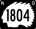
North DakotaNorth Dakota uses an outline of an Indian chief.
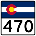
ColoradoColorado uses their state flag.

Less creative is the use of geometric shapes like a square or circle.


Many state shields have evolved over the year as well. Oregon used the fancier outline of their state seal until they modernized to the simpler looking shape.


If you are a road geek of sorts, you have probably enjoyed finding an old original US Route sign on a decommissioned highway. This happens fairly often by accident or omission as they are left behind. Often the old US route number remains as a state highway number, so I guess they can save a few bucks by leaving the sign behind.

Some overhead intersection signs in the Portland suburb city of Tigard, Oregon were recently changed on old US99W. This is now state highway 99W. I noticed it wasn’t the state shape, but it wasn't the US Shield either. They used a fully white Interstate Highway shield. Well, I think someone had a nice historical thought anyway. *

We have t-shirts, hats and other "shielded" items an our Old Route Souvenir Shop.

If you know where an actual old US Route shield remains on a former or decommissioned US Route, please write me at OldRoutes@gmail.com.
If you want to know even more, check out http://www.us-highways.com/ussign.htm from Robert V. Droz.
See all the State Route Shields at http://en.wikipedia.org/wiki/Wikipedia:WikiProject_U.S._Roads/Shields/Database

Get your own realistic US Route Sign.


*99W sign in Tigard Oregon, Copyright 2008 Dan Smith

Monday, June 9, 2008

Route 66's Rock Cafe hopes to rebuild


Part of the fascination of old routes is the life along the old route. Many businesses disappear when the old route is bypassed. Some adjust to the lesser traffic. Some towns may reformulate their entire business district to attract a new clientele, like antique shoppers. Some businesses have held on over the years. They do it for many reasons… to put food on the table… their family has always done it… and some to keep the history alive.
One such place on Route 66 is the Rock Café in Stroud Oklahoma. The restaurant was built in 1938. The current owner, Dawn Welch, bought the restaurant in 1993. In the beginning, she had planned to turn the restaurant around, sell it and move to Costa Rica. However, she had so much fun, she stayed. The restaurant is now listed on National Register of Historic Places. Welch is even one of the inspirations for Sally the Porsche in the animated movie "Cars."
Unfortunately, the Rock Café’s classic neon sign today looks over a burned out building. The restaurant namesake walls remain, but the inside filled with only charred remains of classic memorabilia, chrome barstools, and thank you notes from the makers of the movie, ”Cars.”
The good news is that Welch has apparently forgotten about Costa Rica, she says she hopes to reopen the historic site in about a year.
No more burgers, chicken-fried steak or oatmeal pie, for a little while. Thankfully though, the good memories cannot be burned up.
No one was in the building when it caught fire, and no one was hurt.
The Rock Café is located at on Route 66 at 114 West Main Street in Stroud, Oklahoma.

Photos courtesy Shellee Graham & Jim Ross /route66photographs.com
Our Old Routes Souvenir Shop is open and have Route 66 t-shirts, mugs, hats and more ready to ship.

More Info
Tulsa World story about fire
KOCO-TV story about fire
About Rock Cafe
Rock Cafe's connection to the movie "Cars"